| |
| |
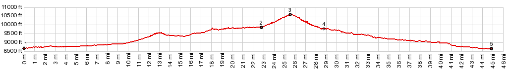
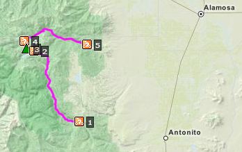
Stunner Pass
This wide dirt road near the New
Mexican border connects the valley of the Conejos
River with Alamosa Canyon. Even though this pass
reaches 10500ft, the area is relatively gentle and
heavily forested. Amidst this isolation sits the
settlement Platoro, seriving your fishing needs at
Platoro reservoir.
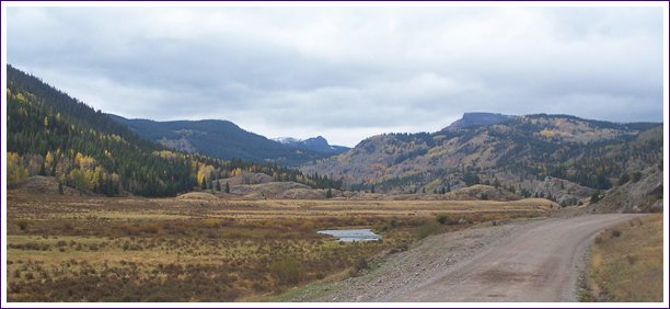
The wide dirt road passes several campgrounds.
Sometimes it is on a bank above the river in this
wide valley, sometimes the road is directly
adjacent to the river. Closeby peaks are in the 11
to 12000 foot range, and I can't quite decide if I
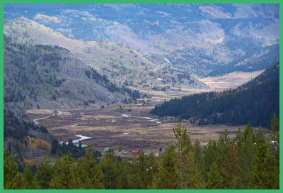
want to call them peaks or plateaus. After travelling so far away from a town of any
appreciable size, Platoro comes as surprise,
because its is appreciable: size: a cafe, dozens
of cabins and signs advertising fishing tackle for
sale, amongst other things. Now there is even a
road sign at the Platoro turnoff. Facing traffic
coming form there, it anounces a distance for
Antonito: 40 some miles, and Alamosa 50some miles
(the "some" actually is a number, but I forgot to
make a note of it) Platoro sits at the foot
of the fianal approach to the top: a couple of
gentle switchbacks that make Paltoro appear more
like a community of roofs than of cabins.
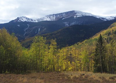
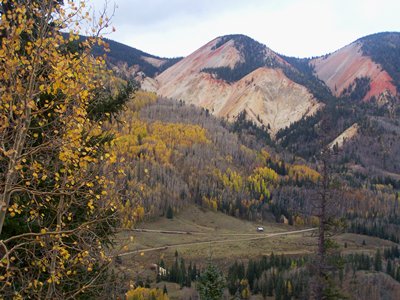
Behind Platoro Reservoir Klondike Mountain (11561)
is the biggest thing around. There is a pass sign
on top.
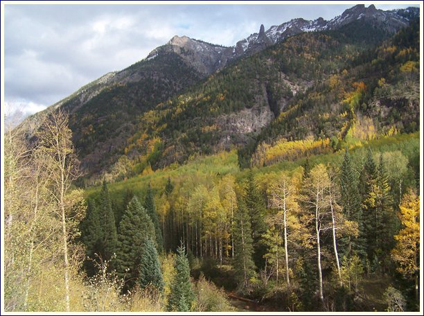
From North. (described
downwards) On this side the road leaves behind its
industrial strength width. A few rocky peaks poke
through the foliage. Before the final part of the
descend into Alamosa Canyon ( I would call it
Alamosa Valley instead ), two signs at a pullout
illustriate the reason, that this route was built
into a wagon road. Below lies the site of the town
Stunner. One lone cabin stands there in its
representation. Behind it a colorful cliff that
must have sent arriving miners into ecstacy. These
colors are the result of heavy minerals, maybe
gold and silver. This is also a good vantage point
to see the routes up Blowout Pass and the FR350
Prospect Mountain summit. The profile continues
down the Alamosa Canyon to where it exits the
Eastern San Juans. Dayride with this point as the highest
summit: COMPLETELY UNPAVED: ( < FR330
Greyback Mtn s(u) | FR611 Alder
Creek - FR630 Aqua Ramon Rd(sh) > ) A day on a tour with this point as
intermediate summit is on page: Elwood Pass Historical Notes: The Gold Rush Period: The road was constructed in 1878 to connect Fort Garland in the San Luis Valley with Fort Lewis near today's Pagosa Springs. Today's paved roads detour either to the south or the north for this purpose. To the the north Wolf Creek Pass is about 800ft higher. To the south you can go from Antonito over Cumbres and La Manga Passes, both within a few hundred feet of elevation, to cross from the San Lewis Valley to the Navajo River. But actually - choosing the Stunner Pass route reaches the Cumbres - La Manga route before crossing the passes, and so you actually have to cross three 10 thousand foot passes. But the descends between these passes are almost non existent. The entire route really stays on the rounded hills of a high plateau. The profile above turns back east into the San Luis Valley instead.
Already a year after the road was built (1879)
prospectors used the military road to explore the
area. When coming up the Alamosa River from the
San Lewis Valley, they would cross the Alamosa
River nine times to reach the town Stunner. The
small town grew to a size of 150 people, and the
inhabitants managed to dig up enough ground for
219 mines. Very few of these produced substantial
ore and by 1916, all that was left were the mine
tailings. These remain today, along with a few old
rotten pieces of wood and several touristic signs
point out this old mining camp, located on the
north side of the pass, where the routes to
Blowout Pass and Stunner Pass diverge. Modern Highways: In 1911 the road was planned to be the major highway over the continental divide in this area. After a flood in 1913 killed many people in the area, the decision was made to make Wolf Creek Pass into a major highway instead.
|
|||||||||||||||||||||||||||||||||||||||||||||||||||
|
|
advertisement |
|
|
advertisement |