| |
| |
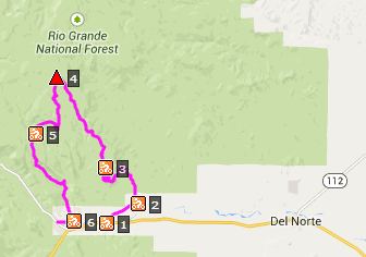
FR611 Alder Creek -
FR630 Aqua Ramon Rd(sh)
This loop first goes to
a transmission tower with an incredible
view over "The Valley", as people of the
the San Luis Valley like to call their
home (as if it were the center of the
universe - who knows, maybe it it is).
After that the road keeps on climbing,
and on the other side, well ... more
below.
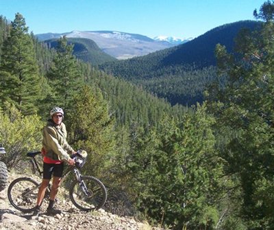
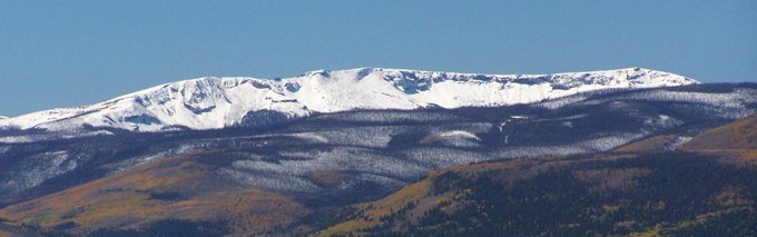
After I finally get rid of them, I notice
the far view of the Sangre de Cristo
Mountains for the first time. It is an
extremely clear day with the first
snowfall of autumn, outlining the peaks in
white. I think in the summer, you would
just look at a blue green layer of haze.
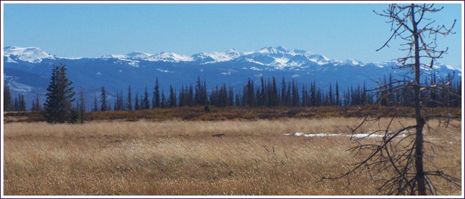
The road switches back under two prominent
rock outcrops now, while I am pedaling
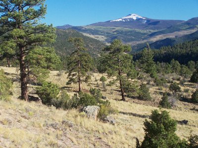
with exhaustion. At the same time one can
gaze at del Norte Peak in the East San
Juan Mtns. A different view of this
landmark peak is immediately below to the
right. The road finally encircles the
second rock outcrop. To the west are
slivers of white plateau tops, like icing
on deep green palisades and forests over
the Rio Grande.
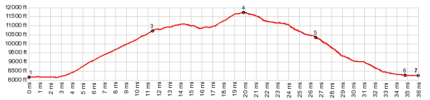
To get to the transmission towers
involves a ~150ft out and back climb over
a short distance. It's not included in the
profile. But the final view of the Sangre
de Cristo Mountains is more than worth it.
Many of the pictures in the slide show
below are taken from this spot. That's the last of "the scenery" for
quite a while, but the road keeps on
climbing anyway. Now it does so without
curves, and intermittently, as the road
follows a plateau top - engulfed in forest
or what's left of it - and pine beetles.
These trees will not be around for much
longer. Actually they are gone already.
After a couple of miles the road becomes
much rockier without warning, and progress
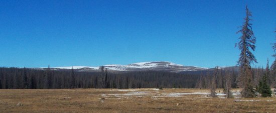
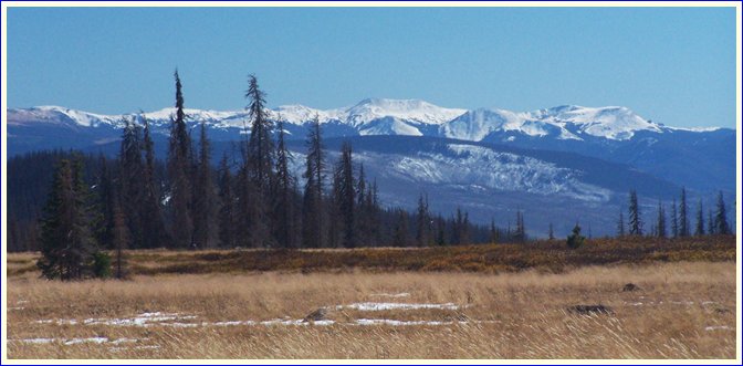
becomes much slower. Approaching the top, the road crosses two
expansive meadows. To the north a high
mountain, shaped like a loaf of flatbread,
is the final destination of FR630 - but
not this loop. At this point in September
it is already buried in snow. To the south
the Eastern San Juan Mountains make a
second appearance. From here the valleys
are out of sight. And the peaks look like
they encircle the meadow like a big
mountain park. But in reality they are on
the other side of the wide valley of Rio
Grande in two directions. At the next signed intersection FR630
turns right, and the shoulder summit of
the route described here, crests at a
small distance further, staying straight
onto FR611. FR630 to the right runs along
the top of Mesa Mountain - the flatbread
loaf. I am told the view from the top is
magnificent, and I have plans to return. The FR610 Alder Creek Road turnoff in South Fork is signed as such on the paved road, that runs along the north side of the Rio Grande, through some kind of real estate development area. Dayride with this point as highest
summit: PARTIALLY PAVED / UNPAVED ( < Stunner
Pass | FR890
Round Mountain (sh) > )
|
||||||||||||||||||||||||||||||||||||||||||||||||