| |
| |
Col du Buis
Between the
suburbs of Nice and N202, following the
valley of Vars, there is a land of many
small foothill passes, that are perfect for
cycling, especially during spring when other
high passes are still snow covered. One of
them is Col du Buis, connectable with Col de Felines,
Col de
Trebuches, Col de St
Barnabe and others in many day loop
combinations
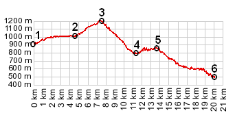
From North. When
descending through the Clue de St Auban from
the town by the same name, the road reaches a
low point when crossing the river Esteron.
This is where the profile starts. The road
rolls gently through the forest, following
every contour of the land. In the quiet old
village of Brianconnet a steep, very narrow
road branches up the hill on the left. It is
written that the road reaches a 19 percent
grade on this climb. If this is really true,
it is a very short stretch. After a short
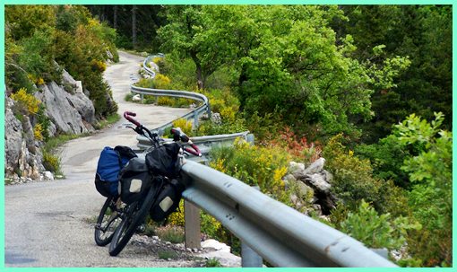
climb the road reaches a summit via a straight
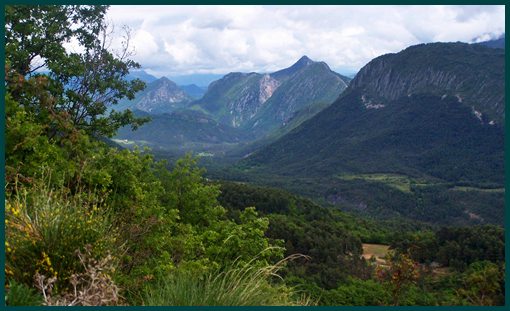
traverse along a wavy guardrail. There is a
really nice views of the hogback hills in the
valley. From South. (described
downwards). A curvy descend through quiet
forest leads to a low point at an interesting
old stone bridge, flanked on both sides by
short steep sections. Four roads meet near
here. Two of them roads lead up more small
named passes: Col
de Felines and Col de Trebuchet.
The forth road also goes uphill from here, but
does not gain enough elevation to make it a
separate summit. This is the path the profile
takes to reach Entrevaux in the Gorge of the
Var. Alternatively one can reach the same
endpoint with just a small amount of
additional climbing by following the other
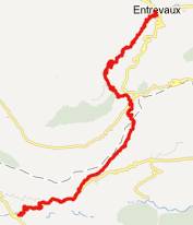
side of the valley over the Col de Felines. A Day on a Extended Tour: (<Col de St Barabe|Col de Felines>)
Col de St. Barnabe , Col du Buis , Col de Felines : La Colle (near Castellane) > Castellane > Demandoix > Col de St Barnabe > Soleilhas > St Auban > Clue de St Auban > Brianconnet > Col de Buis > Col de Felines > Entrevaux : 39.6miles with 4140ft of climbing in 4:17 hours on a fully loaded mountain bike: Notes: includes a mile or two of rolling around Soleilhas and Entrevaux
back to Cycling Passes in Europe |
|
|
advertisement |
|
|
advertisement |