| |
| |
Col de Trebuches
This is one of
several small passes in the area, that can be used
to construct great loop rides. Each one of these
small summits has a special characteristic, that
makes it different from all the others. What's
memorable about this one is a long straight
traverse over the top (bottom right picture in the
group of four). The south side is also a traverse,
albeit a curvy one, but with with a very elongated
viewshed.
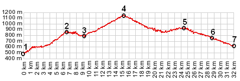
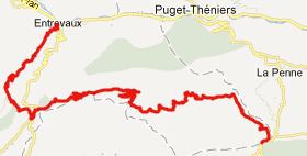
From North. Starting in the valley of the
Vars in Entrevaux, two possible direct routes lead
to point 3: the direct nothern approach to Col de Felines, or
the profiled route, which also goes over a small
high point. The descend leads to an old stone
bridge, near where 4 roads meet. One of them winds
up the forested Val de Chavagne to the west
towards Col de Trebuches. It crosses the top on a
very narrow road in a straight traverse.
From South. (described downwards). This side doesn't "just descend". Instead the road (if roads could do things like this) seems to relish every foot of the small amount of elevation it has gained, and gives it up reluctantly foot by foot, by traversing along the hill side. Along the way it passes small groups of houses, where the debate weather they constitute a village is still open. They do not show up on the attached Google Map. But I have pictures to prove their existence. Actually they also have names: la Rochette and le Bosquet. The second has fewer houses than most people have fingers, but it is still big enough to warrant a small tunnel like bridge construction to get from "downtown" overlooking the eastern foothills to "uptown" overlooking the northern foothills. Eventually after a long shallow roll, interspersed with many flat sections, the profile passes through Saint Piere and reaches the valley of the Milans. Tours A dayride with this point as
intermediate summit is on page: D17-D27
Rourebel(sh)
The last summit point on this Extended Tour with different start and end points is Col de Felines back to
Cycling Passes in Europe |
 Approaches
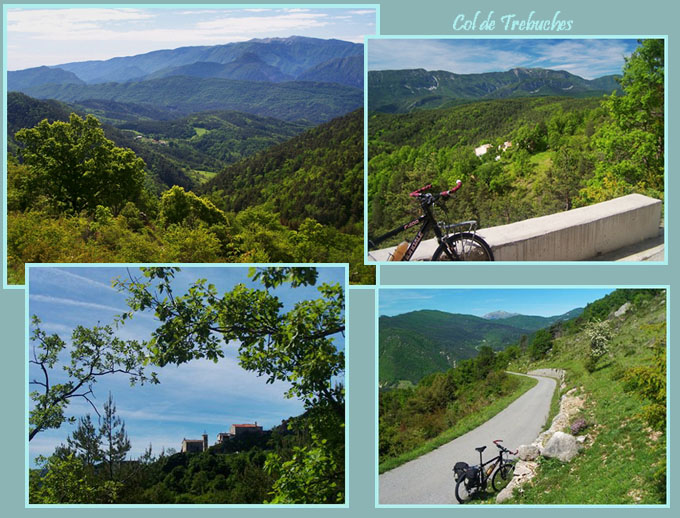
|
|
advertisement |
|
|
advertisement |