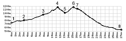
< Left Panel   Passes in French Alps   Areas   Tables   Maps   All Favorites  
Main Panel:   Main Page   Map+Profile   Alps Map  


C3 La Plagne s(u)

I came across this little, but scenically interesting, unnamed summit while riding from the top of Col d'Arces to Col de Feu. But to make this the highest point on a profile, going over Col d'Arces is not a necessary condition. But in order to describe my particular route, the profile goes over Col d'Arces. On the other side Col de Feu has to be a shoulder summit point on any route over C3 La Plagne s(u).
 
1.(740m,00.0km) START-END SOUTH:Boëge
2.(790m,03.0km)Villard
3.(950m,07.7km)Habčre-Poche
4.(1164m,11.0km)Col Des Arces
5.(1000m,12.8km)downhill in right connects with Lulin,a short loop option
6.(14.8m,1175m)TOP: C3 La Plagne s(u) and turnoff to Tres Le Mont
7.(720m,15.5km)Col du Feu(shp)
8.(530m,26.6km)START-END NORTH: Allinges

Approaches

From South.
After descending 150m from Col d'Arces towards Lulin, it becomes clear that you do not have to ride down into the valley yet. Another narrow paved path climbs to the left. It soon reaches a summit, that is just barely higher than the Col d'Arces. From here a dead end road climbs higher to the forested Tres le Mont. It looks like there would be some interesting mountain biking opportunities here, but staying on pavement you are relegated to a forested area around a vacation house without views.

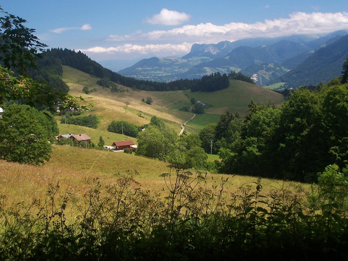
From North. But from the summit on C3 there are a few great views west, comparable with those from Col d'Arces. The profile descends to the Col de Feu, a less interesting spot, compared with other routes in the area. From here you could ride down into Lulin after this short detour. But the profile goes 
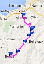
north instead, direction Lake Geneva.

A Dayride with this point as intermediate summit is on page: Col d'Ajon


advertisement

advertisement