| |
| |
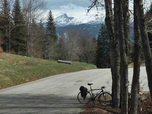
Col de Carri
This is one of several potential
summit points above Col de la Machine and the road
over Combe de Laval. Compared with the former this
is a relaxing ride through the forest with little
reason to stop, and plenty of reason to enjoy
thinking ones one thoughts.
The road remains in the forest to the top. There
is hardly any traffic. The auberge at the top is
definitely closed in this week after easter.
From East. There is a
singular view of the main Vercors ridge, just
lurking between the trees, just below the summit.
Otherwise the views have to wait to the bottom,
which is not far and not low, but a high alpine
valley directy adjacent to the main Vercors range.
 A ride with this point as
intermediate summit is on page: Font d'Urle s(u) A ride with this point as
intermediate summit is on page: Font d'Urle s(u) |

|
|
advertisement |
|
|
advertisement |