| |
| |
Font d'Urle s(u)
Font d'Urle is a little ski town in
the Vercors region. It is surrounded by named road
passes in all directions. What is not immediately
apparent though, is that the town is actually
higher than most, if not all, of the surrounding
passes. ... And since a road goes through it in 2
directions, Font d'Urle becomes the summit
instead of those passes.
Turning south the first climb passes a whole
series of inviting picnic benches in the forest.
It was long past lunch time for me. A picnic bench
was just what the legs had ordered, and it
was hard to pick just one picnic bench, with such
a preponderance of magnificent choices. But
actually the nicest rest benches are -I think- on
top of the first pass: Col de Proncai. There is a
nice sign here with the main ridge of the Vercors
Park in the background. But it is little early to
celebrate arrival at a summt. As nice as this spot
is, it is just a shoulder point for a road ride,
no matter how you look at it. On the hardly
noticeable downhill to a war memorial gravesight,
I have to work noticably hard, because the
wind was just about knocking me over the
backwheels. And then the climb to the next pass started. The
peaks in main ridge of the Vercors are displayed
ever better with rising elevation (picture below).
Another pass sign appears next to the road: "Col
de Lachau" - just a few cars parked around a body
of water in the forest. The road just keeps on
climbing. It does finally top out at the turnoff
to the ski village by the name of Font d'Urle,
just as the road is about to reach treeline -but
doesn't quite do it. The summit point is still a
short distance below the actual ski village. I did
not take the time to check if there was any actual
life in the form of open businesses during this
easter week. 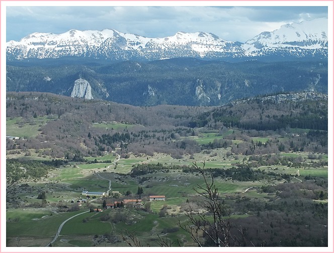 From West. (described
downwards). On this side the road stays in a high
shallow forested ravine. It is a pleasant roll
without much breaking required, and not much
reason to stop. The direct way down leads along
the Col de la Machine and the Combe Laval. This is
the really the scenic high point of my own day
loop journey. But pictures of that part are
included in the Col
de La Machine via D2 s(u) page. 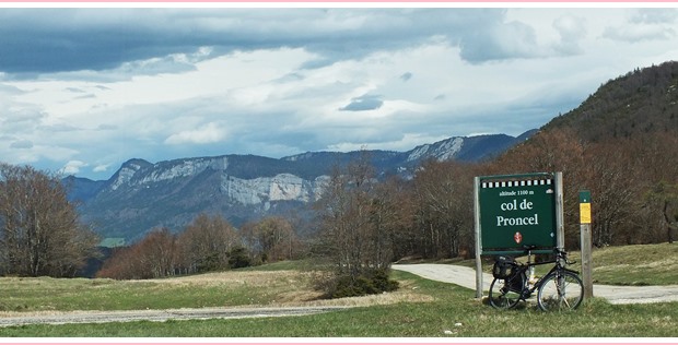 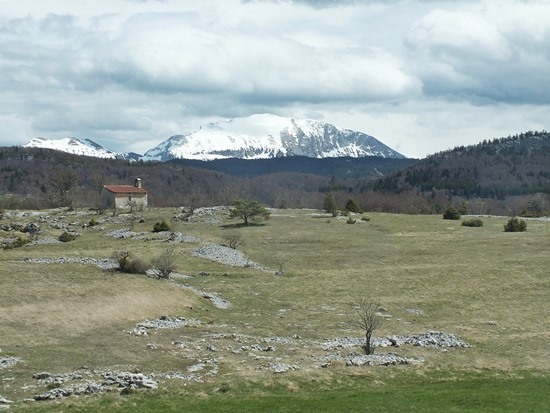 Dayride with this point as highest
summit: Dayride with this point as highest
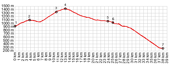
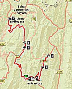
summit:COMPLETELY PAVED: ( < Tunnel du Morier la Sure s(u) | Col de Praletang > ) Font d'Urle s(u) , Col de Carri s(u) , Col de L'Echarasson , Col de La Machine via D2 s(u) : Pont en Royans > Eulalie <> out and back several kms up D518 before realizing wrong way >> Col de la Machine via D2 s(u) <> out and back down Combe Laval witth turnaround point about a km below the comb >> Col de Carri s(u) > D178 south > Col de Proncai(shp) > Col de Lachau(shp) > Font d'Urle s(u) > D76 north > Col de L'Echerasson > D76 east > St Jean en Royan with grocery shopping detour > St Laurent > Eulali > back to starting point in Pont en Royans : 66.3m 9511ft 9.2mph 7:14hrs (garmin etrex30: r5:19.4.25) (Pics: t19_3:1-45) |
 Approaches
|
|
advertisement |
|
|
advertisement |