| |
| |
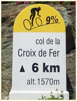
Col de la Croix de Fere
On a sunny summer
weekend this summit feels like the center of cycle
racing culture of the western alps. It's not only
a center of Tour de France activity. It is also a
popular hang out spot, as well as the finish of
many a private rivalry between friends, not to
mention many other organized races, other than
"the Tour".
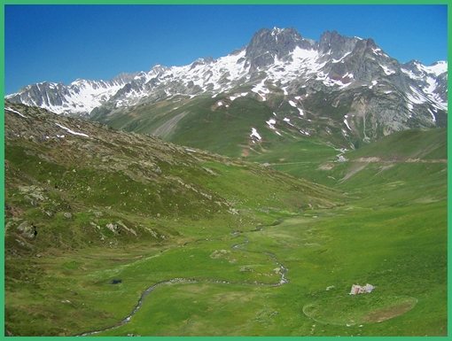
From North. From the top of Col du Glandon,
just a hundred meters of climbing remain to gain
this pass. The route traverses a gentle high
valley, in treeless at half height. You're at the
top before you can actually fully appreciate the
surroundings. Both approaches of Gol du Glandon can
be used to construct one day loop rides over Col
de la Croix de Fere. But the one using the Col du
Glandon southern approach is very long and goes
over Col du
Galibier. Using Glandon's northern approach
to make a loop, Croix de la Fere can be cycled in
a loop without any other additional passes. A nice
optional addition to that ride is Col du Mollard. From South. (described downwards):
Switchbacks and great views last till St Sorlin
d'Arves, a ski resort that attracts just as many
bicycle events when there is no snow, as ski
events in winter. From here the road follows the
valley bottom and descends rapidly towards St Jean
de Maurienne.
History-Cycling.
The pass has been a favorite of Tour de
France route pickers only since after WW2. But
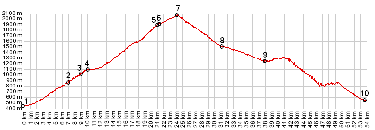
between 1947 and 2012, 16 stages crossed the top. Col de la Croix de Fere, Col du Mollard:
St Alban des Villards > Col du Glandon(shp)
> Col de la Croix de Fere > St Jean d'Arves
> Col du Mollard > Albiez le Viex >
Albiez le Jeune > Villargondran > St Jean de
Maurienne > St Etienne de Cuines > sp:
52.8miles with 6940ft of climbingin 5:31hrs (VDO
MC1.0 m4:12.6.15).
Notes: on a hot and sunny day in June The last summit ride with different start and end points on this Extended Tour was: Col du Glandon
|
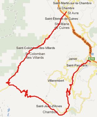 Approaches
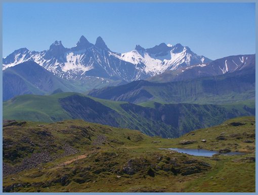
|
|
advertisement |
|
|
advertisement |