| |
| |
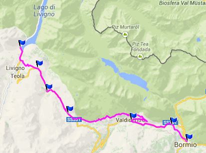
Passo di Foscagno
This pass is the higher of the
Foscagno/Eira double summit between Bormio and the
high skiing town Livigno. On the south side waits
an interesting transition between the greener
landscape of Bormio, and the high glacially silted
valleys above treeline on the Swiss border. The
climb the road has to make, is not as radical as
nearby Stelvio
Pass or Gavia
Pass. But this is the pass, that crosses the
main geographical dividing line in the alps, the
division of watersheds. To the south water flows
into the Po river, to the north into the Danube.
Only a few switchbacks connect long ramps on this
wide road, and so it traverses a lot of space.
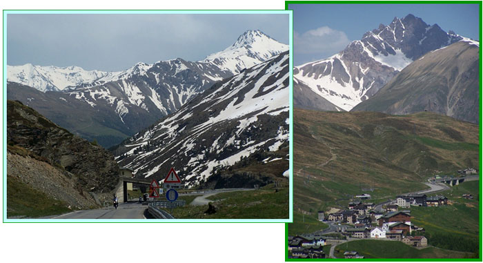
Past the last village Arroga, the road seems to
head for a gap ahead. But that's an opticall
illusion. The road has diffferent plans. It enters
three long galleries. These are located on a
comparatively shallow slope, when you compare them
to the galleries on Stelvio Pass for example. But
they have a panoramic view of peaks to the south. No switchbacks are required to reach this gap
above treeline and the big hotel on top. There is
a customs station on top, even though both sides
of the pass are firmly in Italy.
From North. (described
downwards) A short descent leads to a low point in
a high valley above treeline, before the road
starts climbing agian to Passo d'Eira. This
valley between the two passes does have a road
exit, that leads down to the large damned lake
east of of Livigno, Lago Di Gallo. A canyon leads
there, but no road fits there. Continuing on
pavement, the path obove the trees is lined with
small tourist businesses, monumental houses, ski
related businesses, that all seem to stack up on
top of one another, when seen in foreshortened
persepective during the descent. The 3000 meter
peaks behind the pass are actually north of the
valley, that Livigno sits in. Dayride with this point as highest
summit: Passo Di Foscagno , Passo
D'Eira : Bormio <> Isolaccia
<> Passo Di Foscagno <> Passo D'Eira
<> Livigno <> turnaround point several
km north of Livigno on Lago di Gallo, including
detours in Bormio: 59.1miles with 6665ft of
climbing in 5:51hrs (Garmin etrex30, m4:14.6.9)
|

|
|
advertisement |
|
|
advertisement |