| |
| |
Col Du Granier
Challes les Eaux and la Ravoire,
north of Chambery are surrounded by monumental
limestone plateaus in all drections. But one
landform stands out in particular, and that is the
mountain Grand Granier, a monumental tooth of
rock, that is flatly lit like a molar in a closed
mouth during morning light. The pass between this
peak and the next one to the north is obvious from
just about every point in the valley, and that is
this pass.
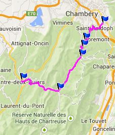
Three approaches meet at the top, and all of these have several variations.
From South. All of
threse three approaches collect traffic from the
valleys and pour them down into the scenic valley
running along the central part of the Chartreuse
Range. Gigantic bands of limestone cliffs either
line the mountain tops with a flat ribbon, or they
define the skyward pointing rockledge of a
triangular peak. During a few switchbacks the road
seems to head for several examples of each. At the
bottom is a nicely kept picnic area and a little
later a sleepy town with a centerpiece church and
a freshly painted WW1 soldier memorial. The
painted eyes and mustache give the memorial a toy
soldier feeling that still feels genuine but
picturesque at the same time. From here you can
climb up again along the center of the Chartreuse
towards Col du Cucheron, or exit the range by
descending Gorge xxx as the profile does 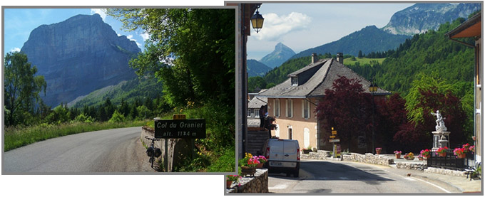
|

|
|
advertisement |
|
|
advertisement |