| |
| |
Alto de Gualchos(sh)
The second interesting peculiarity
of this range is its function as a weather divide.
It acts as a barrier to the often moister climate
on the Atlantic west side. To the east of here the
coast and mountains are clearly even drier. The
Costa del Sol, east of here, is not only drier but
also quieter for a while - less traffic.
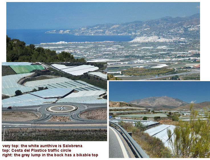
This is also the "Costa del Plastico". The plastic
coast gets its nick name from the large areas of
greenhouses built from plastic tarps (see pictures
below). You can smell the vegetables as you ride
by, especially the esparagus. Even further east,
the dryness climaxes in the area around Almeria,
the driest region in entire Europe. Almeria
also lies in the rain shadow of the mighty Sierra
Nevada.
 Approaches
From East. (described
downwards) A number of switchbacks lead down
through the small village of Gualchos. Below more
of the land is packed in cellophane to maximize
the heat for the fruits and vegetables packed into
them. East of here the coastal resorts have a more
laid back quality, and you practically have the
ocean for yourself, or at least during April you
share them with the vegetables under the
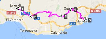
greenhouses. 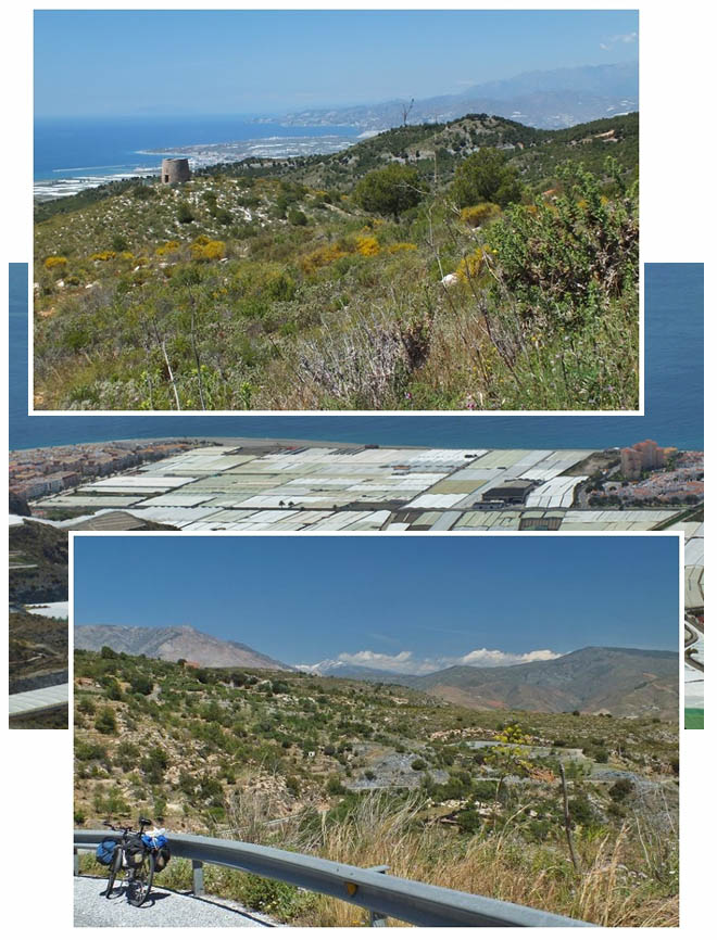 A Day on a Tour with this point as highest Summit: COMPLETELY PAVED: Carretera de Gualchos(sh) : above Collado
de Itr_abo > Itr_abo > Salobrena sight
seeing detour > Mogil > Puntalon >
Carretera de Gualchos(sh) > Castell de Ferro
> La Rabita > Adra: 56.5miles with 3480ft of
climbing in 5:15hrs |
 The Sierra de
Lujar doesn't seem to get very much good press
from hikers. This mountain range is shaped like a
big lump. But these mountains do have some special
characteristics. This group of mountains has a
summit at 1850 meters altitude, reachable with a
road bike, and it is only about a dozen kilometers
from the coast, as the crow flies -that's closer
and higher above the sea than any other point that
I am aware of. (If you know one please send me an
email). But I didn't get there, and the summit
shown here is the lowest crossing of the range,
not the highest, even though the initial part of
the profile from Motril is the same. The Carretera
de Gualchos just cuts off part of the coast
between Motril and Castell de Fero. There are some
great far views of the village Salobrena and the
city Motril along the way.
The Sierra de
Lujar doesn't seem to get very much good press
from hikers. This mountain range is shaped like a
big lump. But these mountains do have some special
characteristics. This group of mountains has a
summit at 1850 meters altitude, reachable with a
road bike, and it is only about a dozen kilometers
from the coast, as the crow flies -that's closer
and higher above the sea than any other point that
I am aware of. (If you know one please send me an
email). But I didn't get there, and the summit
shown here is the lowest crossing of the range,
not the highest, even though the initial part of
the profile from Motril is the same. The Carretera
de Gualchos just cuts off part of the coast
between Motril and Castell de Fero. There are some
great far views of the village Salobrena and the
city Motril along the way.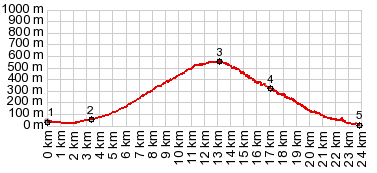
|
|
advertisement |
|
|
advertisement |