| |
| |
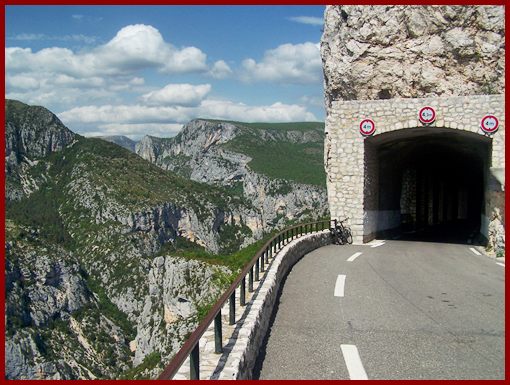
D71 Tunnel du Fayet s(u)
The road on the
south side on the Canyon du Verdon has many ups
and downs, so that it is difficult to feel where
the actual summit points are. You could easily
think that the western entrance to this tunnel is
the highest point along the entire southern rim.
But actually the road crosses higher points in
both directions. But who cares about altitude and
summit points with scenery like this ?
Approaches From West. After reaching the D71 Col
d'Illoire summit, the road continues to
traverse along the edge of the canyon, now often a
little further away from it. It looses only about
350 meters on the downward traverse before it
starts climbing again to the D71 Tunnel du Fayet
s(u). The portal is at the highest elevation. From East. The bridge over the
Canyon de l'Arturby marks the lowest point after
this summit. From here the road starts its scenic
climb over the D71 le
Petit Ste Maime s(u).
A
Dayride with this point as intermediate
summit is on page: Route des Cretes
s(u)
The last summit point with different start and end points on this Extended Tour is: Col de Luens back to
Cycling Passes in Europe |
|
|
advertisement |
|
|
advertisement |