| |
| |
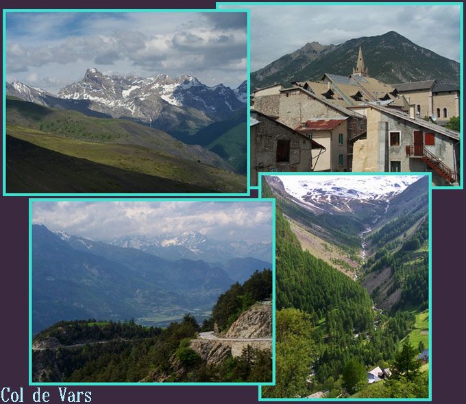
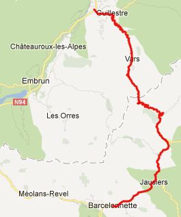
Col de Vars
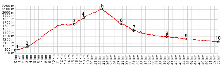
The Col de Vars is
near the center of a whole series of high paved
passes, that spend a majority of their asphalt
above treeline. Many bicycle tours cross this
pass. Weather coming from Izoard to the
north and heading for Bonnette or Cayolle to the
south, or coming from Col
du Larche and heading north, Col de Vars is
on the route. Finally it can also be part of a
partially, unpaved day loop over the Tunnel de
Parpaillon s(u).
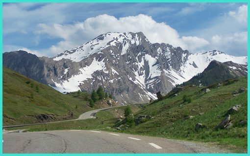
From North. Guillestere is already
located substantially higher than the main highway
in the valley of the Durance. But once past the
rondel south of Guillestre, the climb really
starts. A steep and fairly busy road climbs a
forested ridge, that at times has views on the
surrounding region in three directions. The snow
draped peaks of the Ecrins National Park to the
north vividly illustrate, that this is region is
now part of the "high alps", not the "high
Provence Alps". But in afternoon light the view is
often obscured by thick clouds.
From South. But the surface deteriorates
quickly (ie improves - depending on your point of
view) on this side, keeping speeds more
manageable. Long switchbacks above treeline give a
great view of the upper valley of the Ubaye. The
road leading up this historic region dead ends.
The peak separating it from the strategic route up
Col de Larche is
the magnificent Aguille de Chambeyron at 3412m.
Further down, the traditional metal roofs on the
village houses give off a nicely rust textured
appearance.
 back to
Cycling Passes in Europe |
 Approaches
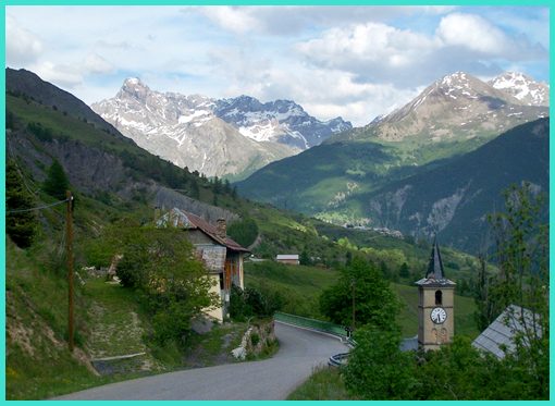
|
|
advertisement |
|
|
advertisement |