| |
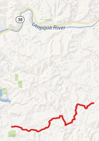
Buck Creek Road via Soup
Creek Road(sh)
Buck Creek Road, Soup Creek
Road and Lindy Bridge Road in Elliot State
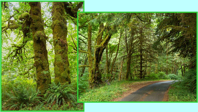
Forest all meet in close proximity. All three
of them are tailor made for tree watching from
a a bicycle. This shoulder summit point is
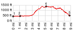
located on Buck Creek Road. But in order for
this to be the highest point you have to
approach it via Soup Creek Road (also see Buck Creek
Road s(u).
From West. South of
Loon Lake, just north of the few houses labeled
as Ash on the map, Soup Creek Road takes off
towards the east. It is completely flat while
passing a few isolated houses till reaching the
junction with the North Fork Soup Creek Road.
Staying right on Soup Creek Road, this becomes a
narrow steep tunnel through patches of old
growth vegetation between other kinds of dense
forest. This road is not quite as overgrown as
the Buck Creek approach, but still narrower than
the Lindy Bridge Road approach From South. (described
downwards) Turing left would go a little higher
over Buck
Creek Road s(u). The profile turns right
and descend Lindy Creek Road, also described on
the Buck
Creek Road s(u) page. A Dayride with this point
as intermediate summit is on page: BLM 23-8-28
Elliot State Forest s(u)
 -
|
 Approaches
|
|
advertisement |
|
|
advertisement |