| |
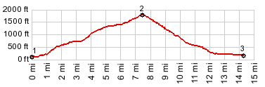
Seven Mile Hill Road s(u)
Two roads on the south side
of the Columbia River are closer to the gorge
than this one. But this one climbs higher and
has more views of the volcanoes, but also
fewer of the inner workings of the Columbia
Gorge. This seems to be a fairly popular ride.
I encountered quite a few other bicycles. This
route easily lends itself to a loop with the US30
Rowena Crest s(u).
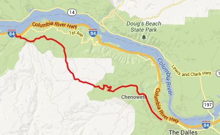
From West. From Mosier 3rd
Ave leads onto State Road. As the road climbs it
can give some really interesting distant views
of both Mount Hood and Mount Saint Hellens. A
special road side attraction is waiting near the
summit. A art gallery of stick figures on
bicycles line the road. Actually it's just the
yard of an enterprising metal worker. But still
- where can I sign up to donate an old bicycle
to this new art movement ? From here it's not
far to where the road jogs left and opens up the
view shed onto the Coumbia River and the Dalles. From East. (described
downwards) A number of switchbacks show off new
vantage points onto the drier landscape of
prarie hills, east of the Columbia Gorge. The
road rolls into the Dalles, which has about
every business imaginable and a nice park on the
Columbia river, perfect for a picnic. Dayride PARTIALLY PAVED / UNPAVED ( < Barlow Pass
| US30
Rowena Crest s(u) > )
|
 Approaches
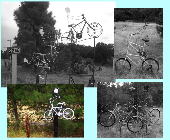
|
|
advertisement |
|
|
advertisement |