| |
| |
Bald Mountain Pass
The Uinta Mountains are the only
major mountain range in the lower 48 states, that
trend in an east west direction. One paved road
skirts its eastern end, historically sometimes
called Uinta Summit.
The higher Bald Mountain Pass goes over the range
near its western end.
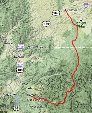
Also designated Mirror Lake scenic byway by the tourist bureau, this road on the northern end of Utah is yet another branch in the tree of scenic diversity that makes up Utah. At 10700 feet it's not only the divide between the Duchesne River flowing eventually into the Pacific, and the Provo River emptying into the Great Basin, it is also the highest Rocky Mountain paved pass road outside of Colorado. This highest paved road in Utah is quite remote with plenty of camping opportunities in and outside of campgrounds, but practically no place to get provisions, outside of water, which is available at the campgrounds. There is a really narrow shoulder but traffic is generally light. But in the summer they all seem to be towing some unwieldy motor contraption. Parking a four wheeled vehicles inside this managed recreation area requires a user's fee - but it's reasonable - obtainable at self service station, 6 dollars for three days, 12 for a week (July/07).
From East. The Uinta foothiills east of
Kamas are a safe distance from the business
traffic of Park City. This climb starts barely
noticeable. But At the turnoff to Soapstone Pass,
everything is still gentle rolling forest, though
rolling upwards. As the route turns north it
finally becomes evident that there are cliffs
behind these forests. At Lily Lake conical
mountains reach above timber line with peaceful
lakes nestled at their feet. The landscape still
has the appearance of a high plateau with lots of
rounded knobs sitting on the table top.
Unexpectedly the road enters forest again. The
final part of the climb includes a few switchbacks
and far views stretching as far as the the
southern Wasatch Range Peaks. The white block of
Mount Timpanogos is partially hidden behind a
straight black cliff with lake at its base.
Between here and the Wasatch Range stands an
expanse of forest, divided by peaks and lakes and
cliffs. As the road crosses the pass the appearance of
the landscape changes abruptly. The plateau breaks
away and opens the view onto the main ridge of the
Uintas. From this vantage point they again have a
somewhat Canadian Rocky appearance. The top has a
name and elevation sign (10759ft) together with a
turnoff to a picnic area and trailheads. Another
sign just west of the summit labels the pass with
its watersheds and gives it a rough 10700ft
elevation.
From South. (also described upwards)
Rte150 heads south from Evanston and traverses
farmland, not in a straight line, but zig zagging
across the valley following property
boundaries. This is the steep side of the Uintas,
and they make an imposing backdrop of rounded
forms to the farmland and distant buildings. The
wide shoulders disappear as soon as the road
crosses from Wyoming into Utah. Approaching the
National Forest boundary a lodge also sells a
miniscule selection of prohibitively expensive
food. Otherwise - no supplies between Evanston and
maybe something in Kamas. The road now parallels
the Hayden Fork of the Bear River and starts to
climb noticably. Traversing an area called
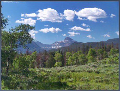
Christmas Meadows near a ranger station, the
distant panorama to the south east has something
Canadian Rocky like to it, where the west face of
Ostler Peak spreads its shadows over the pine
covered hills and expansive meadows in the
foreground. The grade picks up a bit. But without
any major turns or anything remotely resembling a
switchback, the road manages to climb what feels
like a summit. This is where the Highline Trail, along with it
the main Uinta ridge line crosses the road. Topo
maps label this spot as Hayden Pass (10347ft), but
there are no signs at this designation. Bald
Mountain Pass is still a bit further, and this
short section between the two passes is buy far
the most scenic part of the ride. The road rolls
along between peaks and small lakes, the largest
of them named Mirror Lake. Climbing above the lake
a turnoff leads to a viewpoint with the lake and
Hayden Peak behind it, one of many really nice
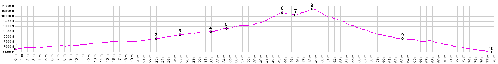
views along the way. Dayride with this pass as highest point COMPLETELY PAVED Bald Mountain Pass x2: Wasatch National
Forest boundary south of Evanston <> Rte150
<> Bald Mountain Pass <> turnaround
point Yellow Pine Campground (and Slate Creek
crossing) just a few miles short of Kamas: 87
miles with 6400ft of climbing in 6:5hours
(Vetta100A r2:10.7.12). ( < FR221
Uinta Mts(sh) ! FR71 Moffit
Basin(sh) > ) A Dayride with this pass as one way summit is on
page: Soapstone
Pass
back to cycling Utah's summits and passes |
 Approaches
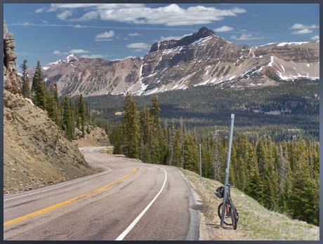
|
|
advertisement |
|
|
advertisement |