| |
| |
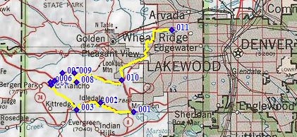
Genesee Park summit(u)
No other paved road, this close
to Denver, reaches as high as the one to Genesee
Mountain. City
View Drive (sh) is ~350ft higher, but it's
also further south of Denver. In order to make
Genesee Park s(u) into a two way summit, the
profile combines the paved approach with a good
dirt road approach from the west side.
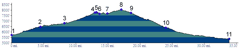
The profile below is identical to
the paved Kerr
Gulch - Co74 shoulder summit for everything
except the section between points 7 and 9. Rather
than continuing on the short section on I70, the
route over this summit detours onto a short hard
dirt road into Genesee Park.
Approaches
Heading in a southerly direction, the road
immediately turns to hard dirt. It stays in the
forest for the first straight climb, exiting onto
a meadow, where you can sometimes see buffalo or
other wildlife behind the high fence. The views
also stretch into the high foothills west and
north. Continuing back into forest, the road
crests at a junction: the two-way summit. Taking a
hard left at this junction, a short dead end road
leads through elaborate picnic structures, that
could only stem from an era when public work
projects were more accepted than today, to the top
of Genesee Mountain. Only the first part is paved.
The top is forested but still has good views in
three directions. There is also a trail to the top
of Genesee Mtn, which reaches 200ft higher. 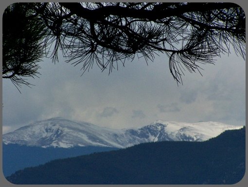 From East. A nice view of Denver near the
top of the two way summit is easily missed. It is
right behind a picnic table, a short distance east
of the summit: Modern large suburban housing units
foreground downtown Denver in the distance, which
looks rather like a set of stalagtites in haze. In
the foothills you can also make out a ubiquitous
shell shaped house poking out of the woods. A
quick descent in forest ends with two tight
switchbacks, and then the route rejoins heavier
traffic and the I70 service route at the Mount
Vernon Canyon - Genesee Trail Rd shoulder
summit. The profile's long descent continues down
Mount Vernon Canyon. But the descend could also go over other points,
that are two way summit points by themselves Lookout Mtn
Rd(sh), or Grapevine
Rd s(u), for example. Lookout Mtn Rd(sh) can
be both an additional summit point (ie separated
by an additional climb of over 100 meters~300ft)
by approaching it over Paradise Rd. It can also a
shoulder point (not separated by such a climb) by
approaching it directly via Lookout Mtn Rd.
Historical Notes
Genesee Park was the first mountain area incorporated into the Denver Parks system. Now ranging in altitude from 6000 to over 13000 feet, the entire area was established between 1912 and 194. Mount Genesee Park is now on the national register of historic places. 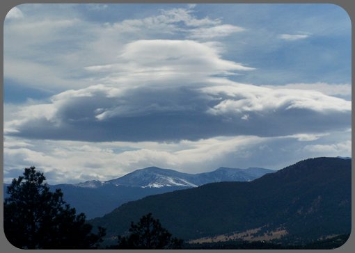 |
 From West. The
profile starts in Morrison to show the maximum
elevation gain. But the description starts at
point 7, a little used exit to I70 that serves a
few houses in the woods, the Chief Hosa
campground, and cyclists trying to ride over this
summit.
From West. The
profile starts in Morrison to show the maximum
elevation gain. But the description starts at
point 7, a little used exit to I70 that serves a
few houses in the woods, the Chief Hosa
campground, and cyclists trying to ride over this
summit.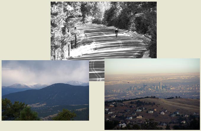
|
|
advertisement |
|
|
advertisement |