| |
| |
Collado de Fadas This double summit over two is part
of the Eje Transpyrenaico traffic route, a fairly
busy road at the bottom, but not at all over the
top. The second Collado is only a shoulder point.
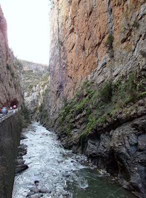
The most rugged part of this road is a canyon on
its west side with 300 meter high, vertical walls
and several short tunnels.
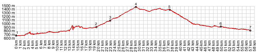
You can see from the profile, that there is
something wrong between here and point 2. No
matter what profile correction threshold I choose,
the spikes remain. This abnomality is Congosto de
Ventamillo, an extremely narrow canyon, with what
often seems like perfectly vertical walls from the
road, It gives me another reason to be glad I am
wearing a helmet, even though I suspect, if
something would come down from above it would be
too large and heavy for the helmet to make a
difference. This is part of the Eje Piranaico and
truck traffic can be a little unnerving on this
shoulderless road, although all drivers seemed
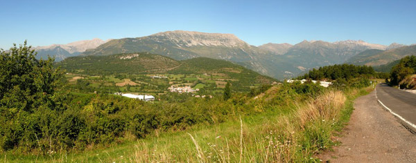
patient enough. Before reaching Castejon de Sos, the road
suddenly exits the canyon into a wide valley.
Castejon seems like a busy tourist town with many
tourist businesses organized around a wide
elongated center - what a contrast to sleepy
Campo. Traffic seems to be much lighter west of
Castejon. By most accounts the pass road starts
here. But in my case the weather deteriorates. I
still get a few good pictures of mountain slivers
between shreds of clouds. But they are quite
different than the far views on verdant peaks,
that I can find on photo sharing site, even though
I do recognize the scences, and can figure out on
what part of the profile they are taken.
There is a rudimentary gazebo set above the road
on the summit. It overlooks the high Pyreneen
border ridge with sweeping tundra slopes to the
north. Instead I take a picture on the north side
of the road: wild bushes with dark storm clouds
revealing an outline of a mountain behind it. It
remains in my own memory. From East. The ride
between the two named Collados over to Collado de
Espina turns out to be wet and cold. But there are
some heavy stone arches in the Ayuntamiento in
Laspaules where I can find some shelter.
Collado de Espina is only a shoulder point on the
profile. On the following descend I get so wet and cold
that I stop in a bakery store, located along the
road, and not near any villages, just in order to
warm up for a couple of minutes. There are two
more interesting locations of towns on a perch on
the way down, Senui and Castarne. I miss the first
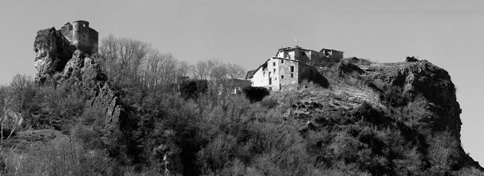
one because of the rain. But the second row of
houses up on the hill even looks good in flat grey
light. I would venture a bet that the
location of the scene in the slideshow is
identical to the one I took. But the lighting on
the included picture is better. Traffic becomes the worst I have experienced on
this tour so far, after the jct with N230 from
Vielha. But it doesn't last long before I reach El
Pont de Suert, where I turn off this road again. A Day on a Tour with this point as highest summit: COMPLETELY PAVED: ( < Alto de Los Molinos s(u) | Creu de Perves s(u) > ) Collado de Fadas , Collado Foradada : Ainsa > Collado Foradada > Campo with sightseeing detour > Seira > Castejon de Sos > Collado de Fadas > Collado de l'Espina(shp) > El Pont de Suert (m5:16.4,5) Notes: gps data and distances are on stolen computer.
|
|
|
advertisement |
|
|
advertisement |