Passo del Lagastrello
Today this is one of several passes in this
densely forested area of the northern Apennin.
It's a sure escape from the traffic in the
valleys and great quiet workout in the forest.
The crossing dates back to ancient times, when
it was used for pilgrimages from the north to
Rome and Lucca in the south.
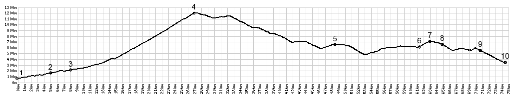 |
01.(70m,00.0km)
START-END SOUTH: SP74 takes off to the
right in the north end of Aulla
02.(160m,4.9km) Monti Di Luccianana
03.(210m,7.9km) Licciani Nardi
04.(1200m,26.9km) TOP: Passo Di
Lagostrello
05.(660,48.1km) Palanzano
06.(610m,61.2km)jct with road to Pignone
on right
07.(710m,63.0km)Lagrimone s(u)
08.(660m,64.9km) Antognola
09.(550m,70.7km) Boschetto
10.(350m,74.4km) START-END NORTH:
Capoponte; bridge over Torrente Parma |
 Approaches Approaches
From North. I was really
glad to get to the starting point of of the
profile near Aulla. The traffic from La Spezia to
Aulla was something, that people who pay for
guided bicycle tours would never put up with, I
thought. But then again I'm not paying anybody to
lead me around - thank god. But once I took the
right turn after Aulla, marked Passo del
Lagostrello, things began to improve quickly.
After passing the two pleasant villages before the
summit and stocking up on lunch tomatoes, there
were so few cars I was going to count them for an
accurate report. But then I got thinking about
other things.
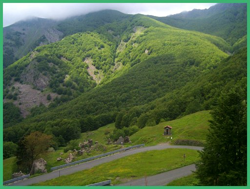
It became quickly apparent that this is a very
pleasant pass. After the coast and all its
traffic, this area seems like a wilderness. A few
km before approaching the summit you pass a few
walls of a medieval ruin. The accompanying
informational tablet says something about a
"wedding present", and goes on to describe the
intricate affairs of medieval nobility in detail.
Today the wedding present stands between two
immaculately paved switchbacks, and makes a nice
place for slicing up some tomatoes for lunch.
After that the road levels out and quickly reaches
the summit. It remains in the trees, but you can
recycle your accumulated touring garbage on top
into color coded containers. Taking a right at the
pass, the road to the right towards Camona keeps
on climbing.
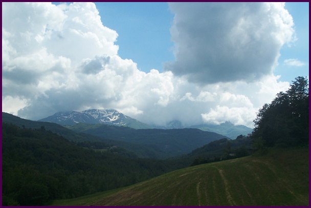
From South. But the
description descends from the pass. The Apennin
Mountains descend towards the north east in a
series of rounded green waves. Not until you get
on top of one of the smaller wavelets between the
pass and the Po Valley, and look back, do you
recognize that there are some large white crested
storm waves in the bunch, ie. mountain peaks above
treeline. These landforms resemble many of the
peaks in my home in Colorado much more than the
vertical walls in the alps. Interspersed with
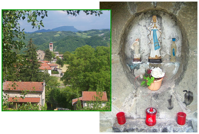
these are pleasant small villages with very few
signs of businesses. All the ones I found were
closed, and that's why this is the only Apennin
Pass in this area I am going to ride over and
write about for now.
Following signs for Parma, there is another small
summit along the route. That point, in my opinion,
has really more interesting far mountain views
than Passo Lagastrello itself.
A Day on a Tour:
( < SP10
Castelnuovo - Seravezza(sh) | Passo della Maniva
> )
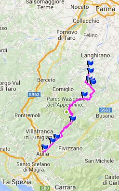
Passo del Lagastrello , SR65 Antenola -
Carpaneto s(u)?: lleaving La Spezia with
detours > Aulla > Passo del Lagastrello >
Palanzano > Sevanizza > Ranzano >
Lagrimone > Langhirano > Torrechiara (about
16km south of Parma): 75.3miles with 6547ft of
climbing in 7:25hrs (Garmin etrex30 m4:14.5.28)
Dayrides between this and the next day
with different start and end points are on pages:
Monte Varagna
s(u)
Passo Bordala
Passo Tremalzo
SP3 Monte
Baldo s(u)
|