| |
| |
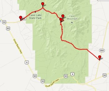
FR50436 Cooper Canyon s(u)
This summit runs parallel to the
paved Connors
Pass, and since I like to combine unpaved
with paved sections in a single route, for me this
made for a great loop ride.
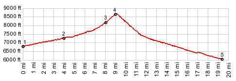
From North. The profile starts at a
lowpoint on the road to Cave Lake State Park,
south of Ely. Rather than continuing straight up Success Summit,
the route turns right to a campground, situated
around that cozy little lake, and climbs from
there. A signed left along the route appears to be
an out and back route to Cave Mountain (10742ft).
Staying on FR40436, the road switches back to the
west and quickly gains the ridge. The view is
obscured enough that you can't clearly see the
peaks in Great Basin National Park. From South. (described downwards) The
immediate view ahead is of a road clinging to the
top of a small ridge, making a nice foreground to
rolling peaks in the Schell Creek Range. As you
start rolling down, it becomes apparent that this
is a spur road, and the direct descent stays close
to the valley bottom. 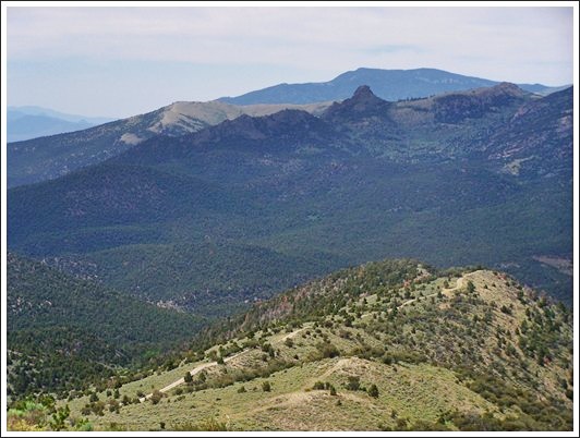
Finally a view of Wheeler Peak (13063ft) in the
national park appears, as background to a winding
road. But a power line also follows the valley at
this point (it crosses the main ridge further
south), so many views are again obscured. Actually
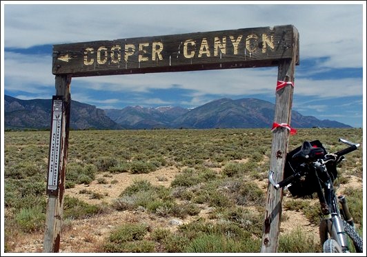
my favorite spot along the route is the end point
of this profile, where a slowly decaying "Cooper
Canyon" sign points the way, and there is also a
360 degree panorama, in spite of the fact that
this actually the lowest point, and not the
highest. Dayride PARTIALLY PAVED / UNPAVED (< Success
Summit | Osceola Road
s(u) >) |
 Approaches
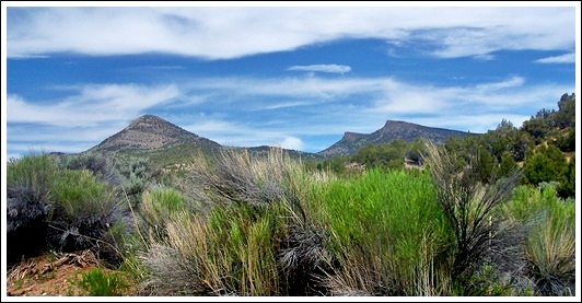
|
|
advertisement |
|
|
advertisement |