| |
| |
Osceola Road s(u)
This is a good dirt road above
the vast Spring Valley. It parallels Sacramento
Pass and can be combined with it in a short day,
or half day ride. A mountain bike race across
Nevada also uses this road.
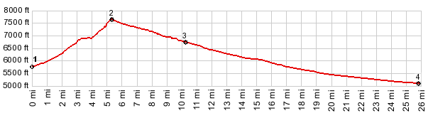
From West. After US50 gets done crossing
Spring Valley in a single line, drawn with a
ruler, Osceola Road appears to continue along that
line, heading up into a gap in the Snake Range,
while US50 detours to the north to find Sacramento
Pass. The good dirt road climbs steeply, but not nearly
as steeply as the foreshortened view from the
valley makes it seem. The road is far from
civilization, water and food stores, it is also
far from undisturbed nature. The road passes
several mines, where people seem to have collected
everything, that won't fit into the regular
garbage for the last hundred years. Finally the
road levels out and contours around an especially
messy mine, like an airplane in a holding pattern.
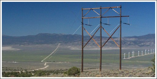
Far below, regularly arranged rows of windmills in
Spring Valley give off an other worldly
appearance. Now the road finds a forested path, following a
ravine, passes one more "private - no trespassing"
sign protecting rusted cars and rotting timber,
and then it's just forest and sweat to the summit.
The highest point is at a cow grate in low brush
forest. Two roads to the right in the summit area
climb higher and, according to the map, also lead
back to the Sacramento
Pass Road, further down valley than Osceola
Road. I followed one of these roads for a little
distance and the route becomes much rougher than
the "civilized" Osceola dirt road. (That's why
this is a summit, not a shoulder summit) 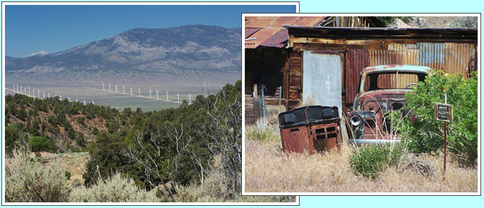 From East. (described downwards) A fast
straight descend affords a few views of the next
range to the east, the Burbank Hills. Where
Osceola Road joins paved US50 coming down Sacramento
Pass, a parking area so large, it's called a
recreation area, spreads out. There is small sign
with a short, concise history of the area. The
profile continues on US50 to a low point in the
Snake Valley. Dayride. PARTIALLY PAVED / UNPAVED ( < Cooper
Canyon s(u) | Robinson Pass
> ) |
 Approaches
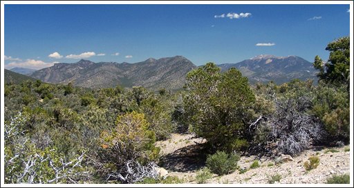
|
|
advertisement |
|
|
advertisement |