| |
FR1828 Lolo Pass s(u)
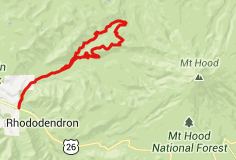
Lolo Pass,
perfectly situated on a flank of Mount Hood,
is only paved on the south side. I learned
this fact when looking for a way back down the
north on my road bike. But actually there is
another way back down, arguably even more
attractive than the East Lolo Pass road. It
goes over a slightly higher summit on FR1528.
That is the subject of this page.
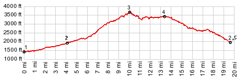
From South. The ride up
East Lolo Pass road is described on the Lolo Pass
page. On top of the pass there is only one way
to continue on pavement. FR1828 descends ever so
slightly and then gradually climbs to a higher
altitude on the forested slopes of lower Mount
Hood. From South. This road has
lots of sloughs and can be pretty rough with
other surprising, never-before-seen pavement
features. Climbing this side may be better than
descending with delicate tires or wheels. This
road is on the other side of the valley,
directly across from the southern approach.
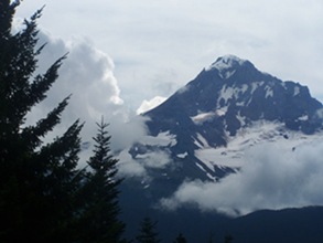
There are two points where Mount Hood becomes
visible, first at the junction with the road
continuing on to Top Spur Trailhead, and another
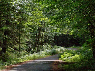
one a little later. In a way this road is the
best of two worlds. It's the thick, impenetrable
tunnel through the forest road, that is typical
for Oregon, but it also has a few far views. But
it does not have the old growth forest patches,
that are typical of summits closer to the coast.
The road joins the Lost Creek access road where
it crosses a creek (labeled as Muddy Fork Rd on
my de Lorme Gazeteer). Shortly after that it
joins back to the southern approach. 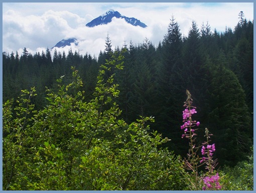
- |
 Approaches
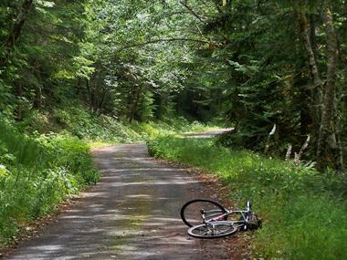
|
|
advertisement |
|
|
advertisement |