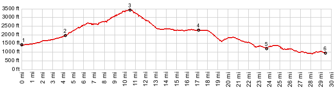
| |
Lolo Pass
Four roads meet on top of
Lolo Pass. This page profiles the most obvious
and direct of the two approaches. One is
paved, the other one is rough gravel. There is
also another paved approach to the top. Both
paved approaches come from the south and are
on the FR1828
Lolo Pass s(u) page.
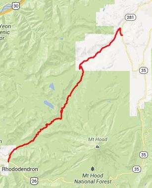
From North. The ride up
East Lolo Pass road is first of all a great
escape form US26 traffic. And the scenery is
nice too. The first few miles lead through
homes, I suspect they are fairly high income
homes, but they are discreetly hidden in thick
forest. After passing the tunoff to the Lost
Creek area ( a whole collection of camping areas
and trailheads) the road traverses up a ridge
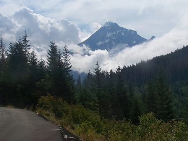
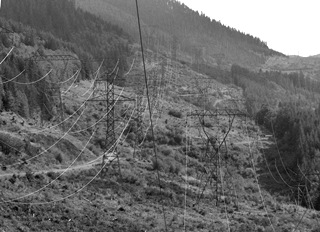
facing the south side of Mount Hood. Too bad all
these huge powerlines get in the way of the
views. Actually the road follows a large
clearcut made for these powerlines, and without
these clearcuts, you might never see Mount Hood
from the road. On a final part of the climb to
Lolo Pass, low hills get in the way of views.
FR10 branching off to the left is barricaded. On
top of the pass there is only one way to
continue on pavement. That option is profiled on
the FR1828
Lolo Pass s(u) page. From South. Instead this
profile takes the most obvious way down the
north side, on a very rough dirt road, following
the power lines. Thanks to the clear cuts the
views of Mount Hood are only obscured by
geometrical patterns of sagging lines, instead
of being completely invisible, because of being
obscured by trees. This rough section is very
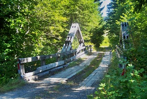
short, and pavement picks up again after the
road crosses Red Hill Creek on a rickety bridge.
My own route went back uphill at the junction
with FR16, but the profile continues north on
FR18 to Dee.
I have been told that the other
unpaved road at the top (signed as Lost Creek
Road) makes for a smoother descend on this side
and joins the described southern approach near
the Red Hill Creek Bridge.
- |
 Approaches
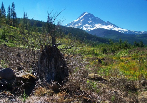
|
|
advertisement |
|
|
advertisement |