| |
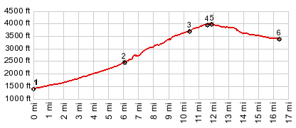
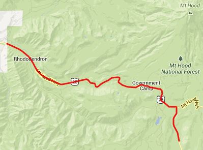
OR35 Government Camp(sh)
This busy highway shoulder
seems to be often on a route with a different
objective. The best to ride this road that I
can come up with, is to ride the whole
elevation gain to the Timberline
Lodge summit on Mount Hood. All of the
profile below minus about a hundred yards is
included on that page. The point described
here is also part of a completely paved ride
around Mount Hood
Approaches (see the Timberline
Lodge s(u): Mount Hood page A Dayride with this point
as intermedate summit is on page Bennett Pass. - |
|
|
advertisement |
|
|
advertisement |