| |
| |
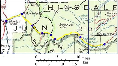
Stony Pass
Stony Pass was one of the first
connections between the remote alpine Silverton
area and the outside world. It started as a
long, rambling wilderness route and it still is.
People from southern states have a long history
in exploring Baker Park, as the Silverton area
was called. Still today, jeep convoys, all with
Texas license plates are a common sight in the
summer. Stony Pass is much smoother than the
name would lead to suspect. Unstony Pass would
be a more descriptive name.
From East. The turnoff to Stony Park
looks like any of the numerous gulches leading
from the Animas Canyon to uncountable mine
remnants, just a narrow dirt track disappearing
into the forest below lava plated peaks. From the
bottom there is no hint that this little road just
keeps on climbing till it can climb no more. Immediately after the turnoff a left fork leads to a spot, where tourists pay money to be shown mine ruins. The left fork eventually joins back with the right fork. But the right fork is the more gradual approach to the pass. At the point of reunion Stony Pass leaves Cunningham Gulch by steeply switching back up the left flank. After the junction with county road 3b a short, shallow downhill leads to an extremely steep section, where the road climbs the step above treeline. A few more switchbacks gain little of the "as the crow flies" distance to the summit. The summit passes between two crowning rock formations. Only the north eastern one seems to be named, Canby Mountain (13478ft). From West. (also described uphill) The
description begins at Timber Hill, about 7 miles
upstream from Rio Grande Reservoir, which is as
far as I got so far. The path at this point is
narrower and much rougher than further up the
pass. A small descent leads past the turnoff to
Kyte Lake, to a crossing of Pole Creek. Even in
late July the creek carries enough water to make
riding through it impossible. But a portage is no
problem. From here the ascent leads straight up
the valley, aiming squarely for the pass. The road
is smooth and very rideable. Only a few curves
traverse into the hillside, before again taking
aim at the notch between the two 13000 foot
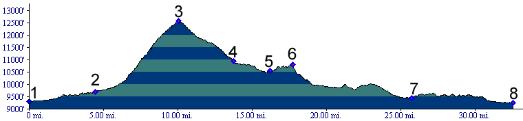
castles ahead. Dayride with this point as highest summit: COMPLETELY UNPAVED: Stony Pass x2: . An out and back
ride beginning in the Eureka area in Animas
Canyon, crossing the pass and descending as far as
Timber Hill, then returning the same way measured
33 miles with 5600 feet of climbing in 5.1 hours.
(m3:06.07.23). 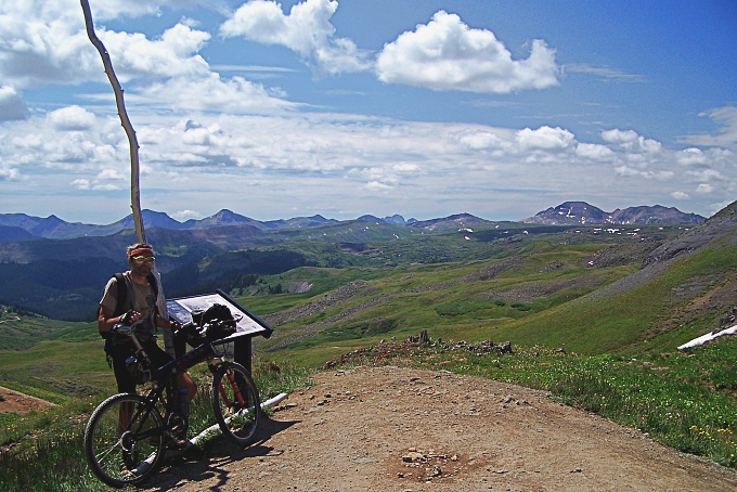
History What is a remote wilderness route today, started
in a similar environment as a Ute Indian trail.
While searching for a way from Santa Fe to
California, Escalante and Dominquez knew of its
existence. First knowledge of the pass to the
Anglican America world is usually credited to
Charles Baker, a southerner looking for gold in
the north. For a while the entire valley carried
his name, Baker Park.
This is the last pass in this thread, that played
an important role in developing the San Juan area
during the boom days. There are however other,
even steeper passes that served traffic to local
mines, such as Hurricane
Pass. Hayden Survey:
During the summer of 1874 the Hayden Survey was
engaged in an elaborate search for a route
suitable for heavy mining equipment to Silverton.
In the process they had mapped areas below Engineer Pass, Red Mountain Pass
and lastly Lizard
Head Pass. During all this time Stony Pass
was already well used. The Hayden Survey had
finally found a route to their liking too, when
they explored the already existing pack train
trail up Stony Pass. The miners called it Rio
Grande Pass, or Cunningham Pass after the promoter
at Cunningham Gulch, which is really the name of a
nearby alternate summit. Rhoda measured the
altitude with a single reading of his barometer at
12090 feet. They examined the route down towards
the supply town of Del Norte as far as Lost Trail
Creek. After the work was done, they entertained
themselves by climbing the classic Rio Grande
Pyramid, 12 miles southeast of Stony Pass.
|
 Approaches
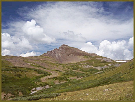 The Leadville Boom Period (
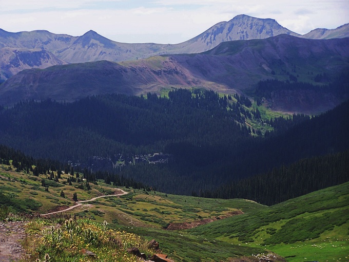
|
|
advertisement |
|
|
advertisement |